Back to Parent

Outcome


Statement

City planning and design has come a long way from urbanist theories like 'Garden City' with their isolationist ideologies. The built environment is mimicking the internet in its search for interconnected-ness. The advent of new-age spaces like 'Live-Work' and 'Couch Surfing' have spawned entire industries. These spaces have been discovered in the intersection of non-traditional and yet surprisingly sequential information. Hence the potential of this project is to form the basis for a corollary: if we study the nature of locations, can we predict their use? In essence: Can we identify the potential of real estate using social media data? 

Social Data

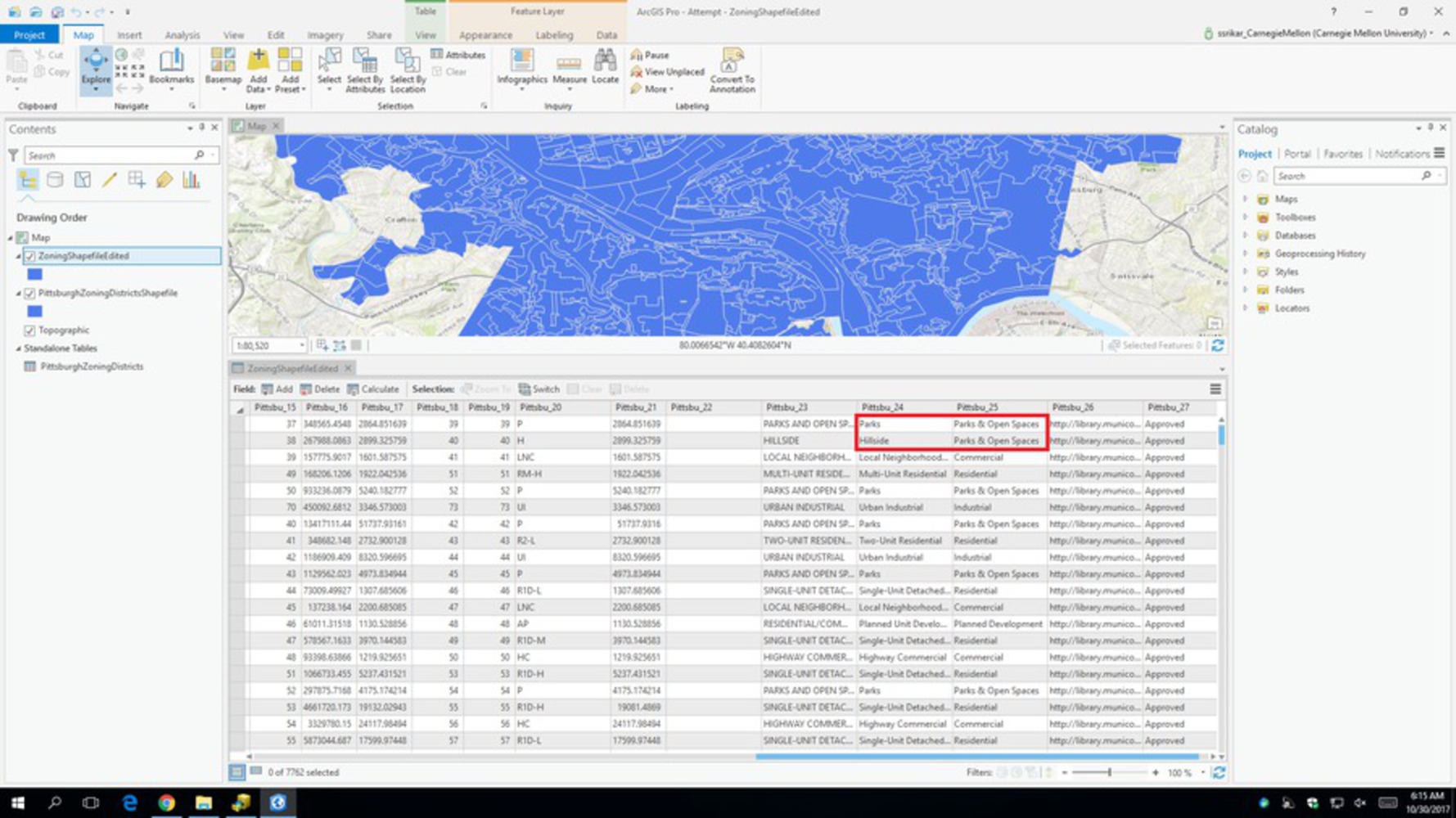
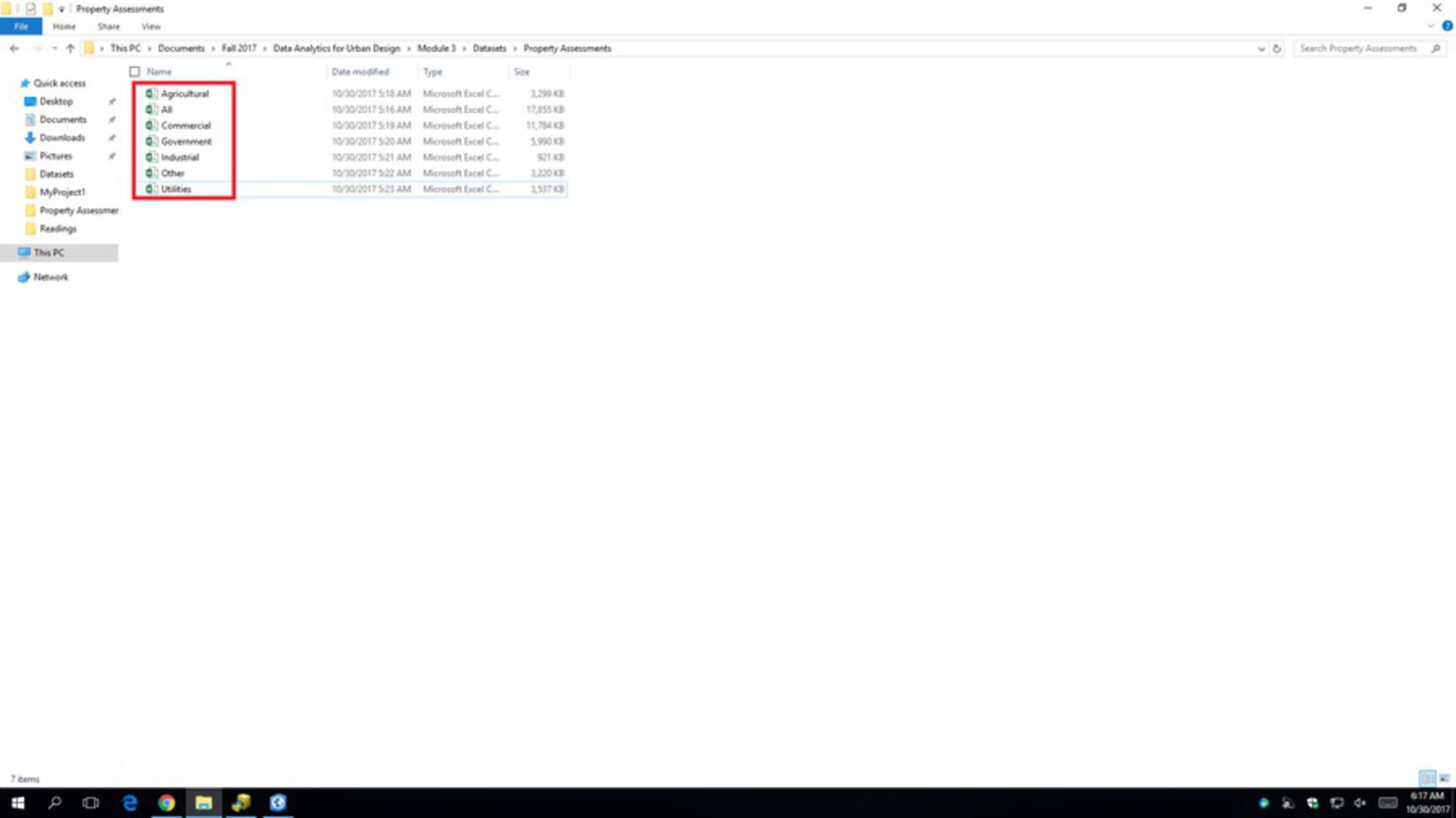
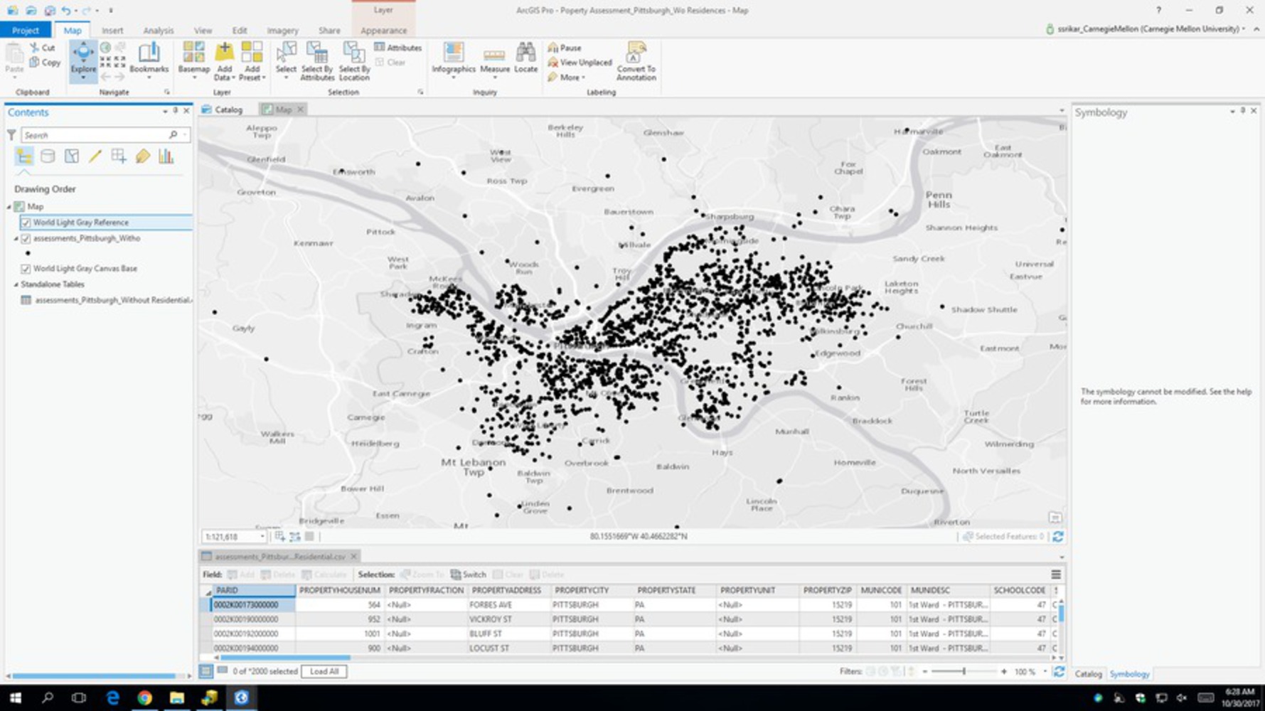
The data used required pre-filtering and spatial filtering. For instance the classifications for categories like Public Facilities etc. were clustered into fewer and similar categories. Other data sets that were shape-files required spatial joins made over ArcGIS Pro. The major category which was the Property Assessment data needed to be cleaned up (Removal of Residential Category) and broken down so that it could be used effectively on Carto.

  • A social data set which you have personally assembled.
  • An approach for analyzing the dataset and an accompanying description of the process + rationale for the approach
  • A final representation/visualisation of the dataset
  • A description of the outcome, insights generated and lessons learned.
Datasets 1.thumb
Show Advanced Options
Datasets 2.thumb
Show Advanced Options

Approach

The approach to this exercise was to have a hypothesis to prove. Given the problem statement, preliminary logic would point towards check-ins and photograph posting being the most popular way of sharing information about interesting locations. If we take this assumption forward, we can try and analyse these two streams of data by contrasting them against geographic locations and see if they form clusters around specific areas.   
The first approach was to analyse the WPRDC dataset on Property Assessments in Allegheny County. At the onset, the dataset was far too big (418832 kB) to upload to Carto or indeed most other cartographic analytical software. However, after cleaning the data up, the bigger issue was realized as the geo-reference being Zipcodes instead of Latitude and Longitude and Geo-coding addresses while possible would cost. 

Final product 1.thumb
Show Advanced Options

However I tried to overcome this by separating the data and arranging them in layers.

Show Advanced Options

To overcome this setback, I tried to structure a three pronged investigation of metadata on the locations and find ways in which to describe Pittsburgh and what might be the experience of those tweeting from those locations:

1. The first one would have to understand the basic land use ordinance issues of the locations. This seemed to prove the hypothesis that vibrancy or check ins are more popular around non residential areas. Pittsburgh in particular benefits from having long river fronts and industrial spaces that have heritage value. 

Show Advanced Options

2. The next piece of information that would be vital would be in terms of sale: both availability and value of properties. This was important to understand two things: 

- One is whether people were more interested in documenting built spaces that have congregational value or natural spaces that may be in the public realm and might not be for sale.

- The second was to investigate whether there were popular nooks and crannies tucked away in unorthodox areas that may not essentially be clubs and restaurants located in very expensive real estate.

The intention of both these questions was to understand if there is an alternative business opportunity that real estate developers may want to pay attention to- the findings did not disappoint.

Show Advanced Options

3. The final criteria for better understanding of spaces were to question the soft incentives for a person to leave the comfort of their home to venture out and document the experience. The easy answer to this was food to be the aspiration and public amenities to support the experience. Since these were need based, they didn't seem to have much effect on the documentation aspirations of social media users. 

Show Advanced Options

Reflection

I have personally never thought about social media much. This exercise was, in many ways, an introduction to the macro level impact of social media and its effect on our day to day experience. That the seemingly virtual world of Twitter, Foursquare and Instagram could clue us in on the most ancient and physical of entities that is 'shelter' was fascinating to study. 

Drop files here or click to select

You can upload files of up to 20MB using this form.