Back to Parent

Outcome


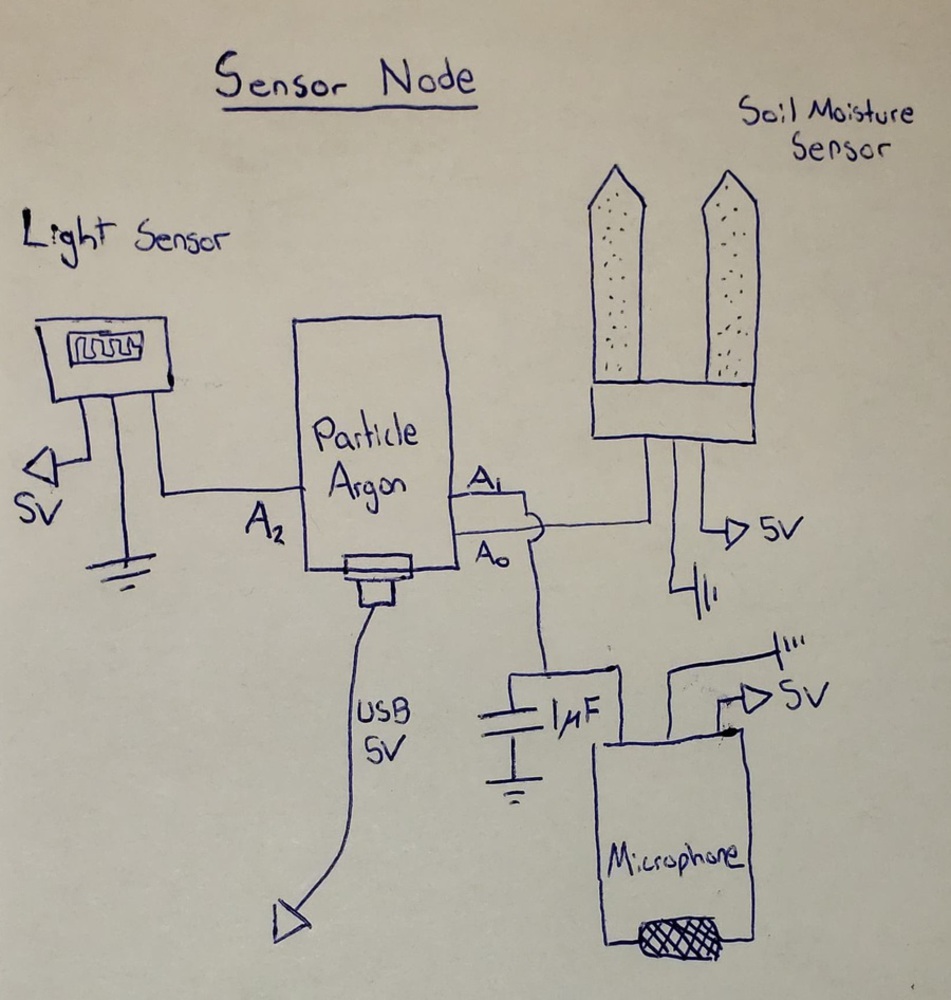
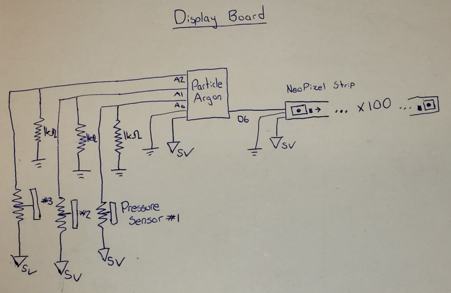
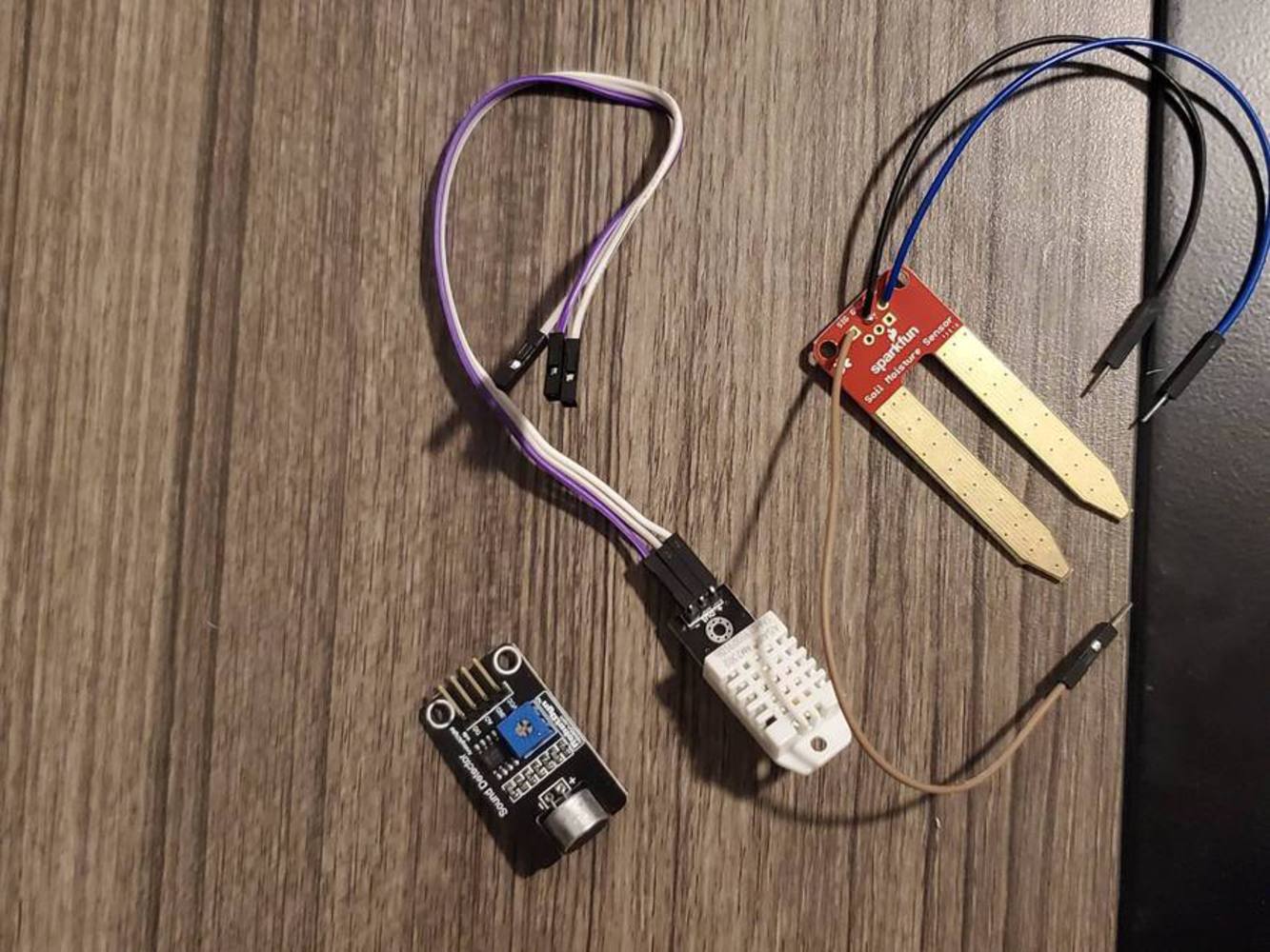
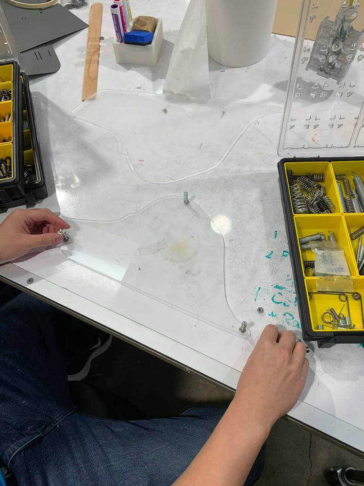
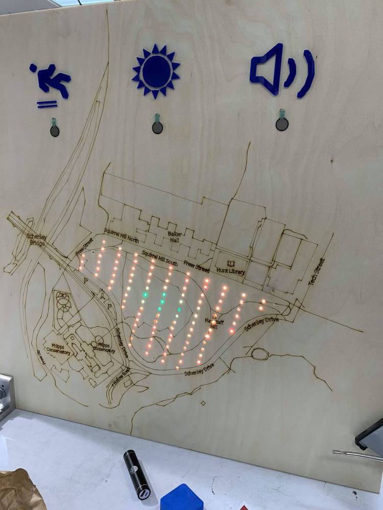
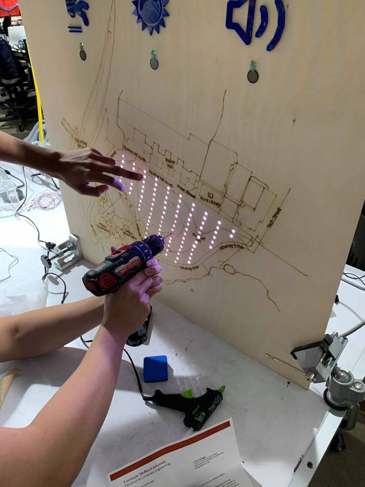
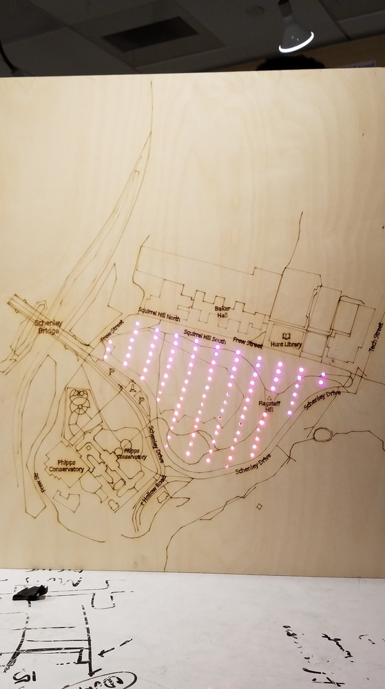
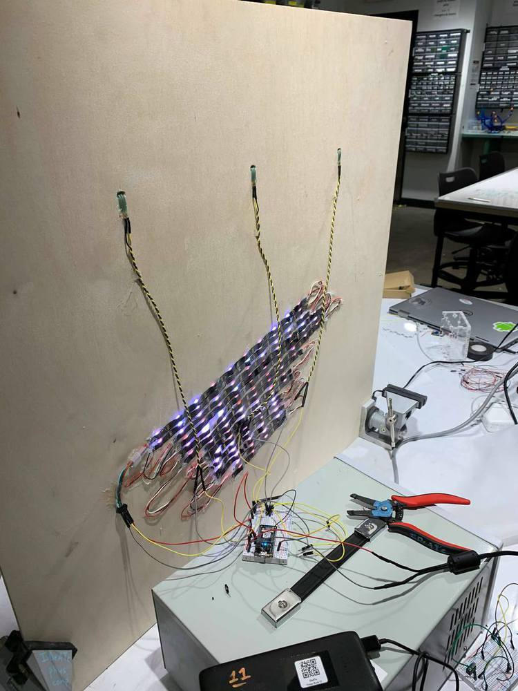
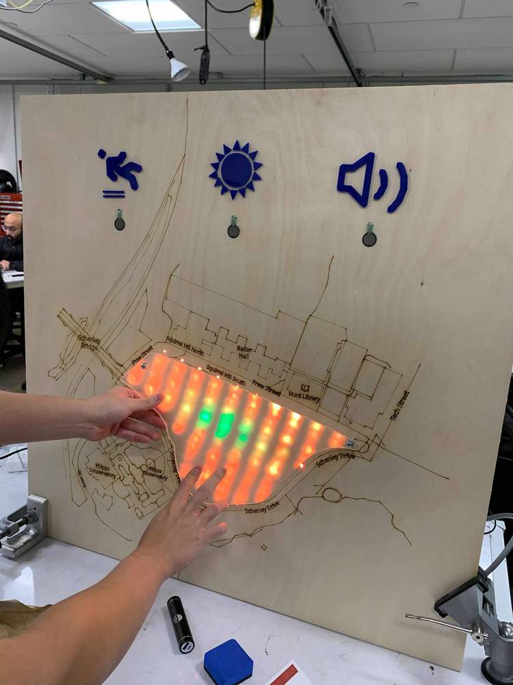
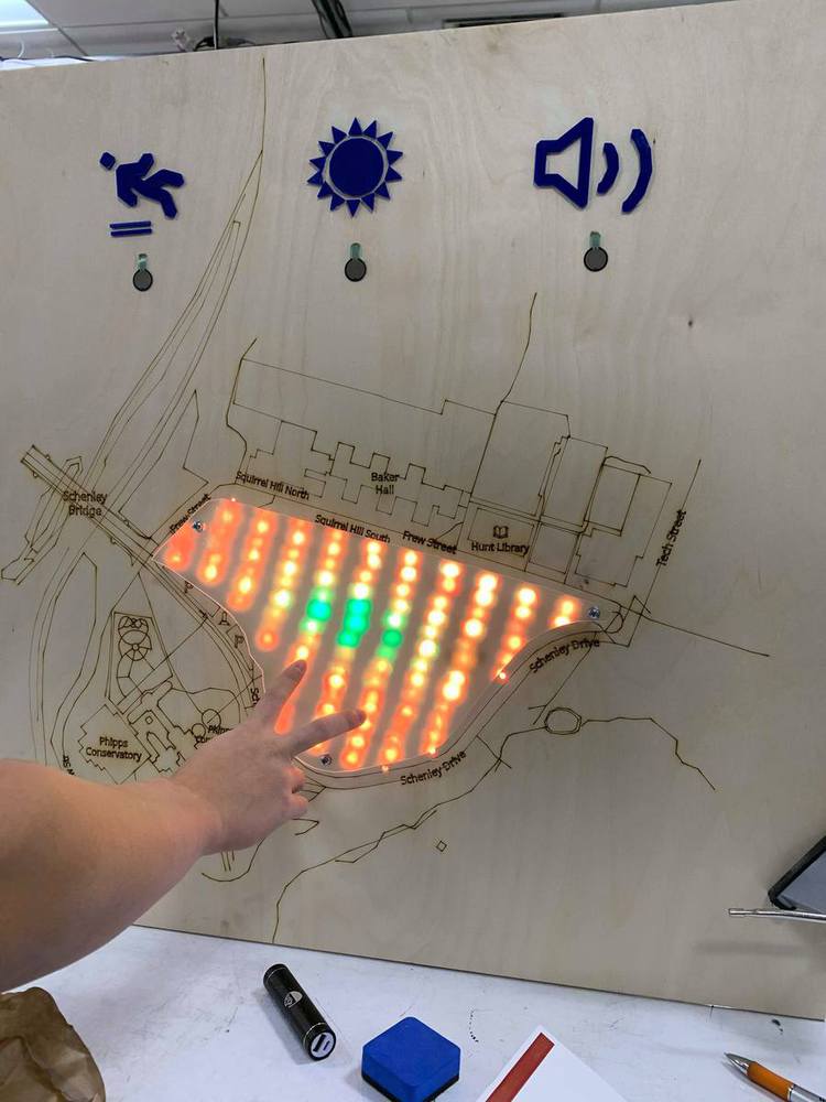
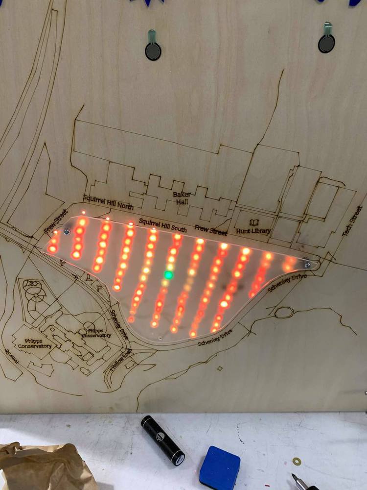
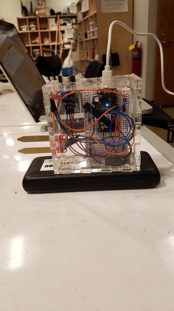
For our final project, we developed an integrated and exciting product that helps park-goers find places in the park for activities. We developed a sensor module and a board module. The sensor module reads the soil moisture, light level and sound level. Then, it sends this information to the cloud, so the board module can consume the data. If the data value has a large magnitude, it means the board component for that sensor will be colored green. If the data value has a small magnitude, it means the board component for that sensor will be colored red. The users are able to select which sensor component to display by pressing a button. After pressing a button, the board will display a heat map of the sensor value intensity. 

Our product can be extended to support multiple sensors. For our demo, we only had one sensor and made the radius of impact very large. Ideally, we would have more sensors and each sensor would affect a smaller part of the board.

Process

  1. We first found an SVG of Flag Staff Hill on OpenStreetMaps. We converted this SVG into a format that could be printed by the laser printers.
  2. Then, we drilled 101 holes on the board and soldered 101 neopixel lights together.
  3. We then mounted all of these lights in the holes we drilled
  4. We started to implement the board module by making a simple program that turns on all the lights
  5. We installed the 3 buttons and laser-cut icons for them on the board.
  6. Then, we started to implement the sensor module. It was short to implement since it only has to upload the sensor readings to the cloud. It maps all the values to a number between 0 and 255.
  7. The board module was then programmed to receive these values and calculate a gradient based on the intensity of the value.

Outcomes

We were able to implement an interesting prototype that many people liked.

Show Advanced Options

Display Board Circuit Schematic

78964031 2832853146765921 7002679022027014144 n.thumb
Show Advanced Options
79091834 2587369207999262 7305719579286700032 n.thumb
Show Advanced Options

Design Challenges

The main design question we faced was whether to display raw sensor data on the map or to act on the data for people and display which areas are good for what activities.

After talking with the experts for Deep Local we decided to give as much power and freedom to the user as possible. Only an individual themselves know what conditions they are searching for. Whether they want to read a book in the sun or the shade is not something we can rightfully decide.

Another design challenge was figuring out how to help users quickly orient themselves on the map. We allow users to press down on the diffused LED panel to see the details underneath on the map.  

Next Steps

  • To deploy the prototype, we need to assemble more sensor nodes and calibrate our data for the varying topography and conditions of the hill.]


  • Approval and funding from the city of Pittsburgh, as well as completed construction of power and wi-fi infrastructure


  • Add a more clear way to describe which metric is being shown - likely an additional indicator light next to each icon, or making the icon itself light up.


  • Add a clear way to demonstrate to the user what red and green mean. In some cases, it can be ambiguous what is good and bad - for example, looking for sun or shade.  
Show Advanced Options
78200239 535070437223092 5930648085364473856 n.thumb
Show Advanced Options
78957585 554190408493473 355836739098509312 n.thumb
Show Advanced Options
78713135 497653061095274 8645202742266036224 n.thumb
Show Advanced Options
78907319 1091776324487625 8162391612958179328 n.thumb
Show Advanced Options
79306435 824508284680952 126135325398401024 n.thumb
Show Advanced Options
79409712 638740063327385 6164143681763803136 n.thumb
Show Advanced Options
79363921 846931245739129 1671459907049619456 n.thumb
Show Advanced Options
79449954 732591360565080 6260990594378629120 n.thumb
Show Advanced Options
79777476 575220443047956 2629543986959745024 n.thumb
Show Advanced Options
79786876 517725405483187 3153948275346767872 n.thumb
Show Advanced Options
80188791 2222121888091242 2415992440566579200 n.thumb
Show Advanced Options
Drop files here or click to select

You can upload files of up to 20MB using this form.