Ball parks & Courts

Made by Tamara Cartwright

Happy City by Charles Montgomery focuses on the measure of success of a city based on how active the community is. Aligning with that study, is the study of both public and outdoor space. Where does the City of Pittsburgh fall in this alignment?

Created: September 28th, 2017

0

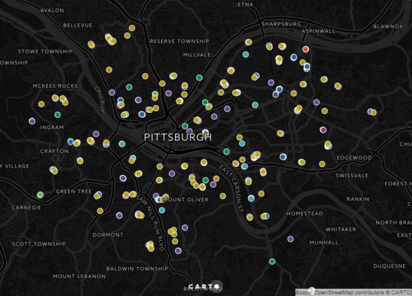
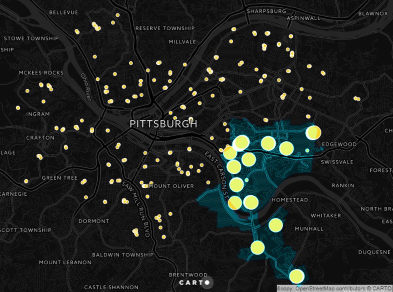
To me, there is a lot to be said about the happiness of a city depending on the amount of public space available to its community. Happy City by Charles Montgomery focuses on the measure of success of a city based on how active the community is. Aligning with that study, is the study of both public and outdoor space. I decided to use the Western Pennsylvania Regional Data Center (WPRDC) Creative Commons to analyze the amount of ball parks, basketball courts, tennis courts and other outdoor sport areas throughout the City of Pittsburgh. 

Data Set: 

City of Pittsburgh Courts and Rinks: https://data.wprdc.org/dataset/city-of-pittsburgh-courts

 & 

City of Pittsburgh Playing Fields: https://data.wprdc.org/dataset/playing-fields 

The Data is updated weekly- both were last updated September 23rd. 

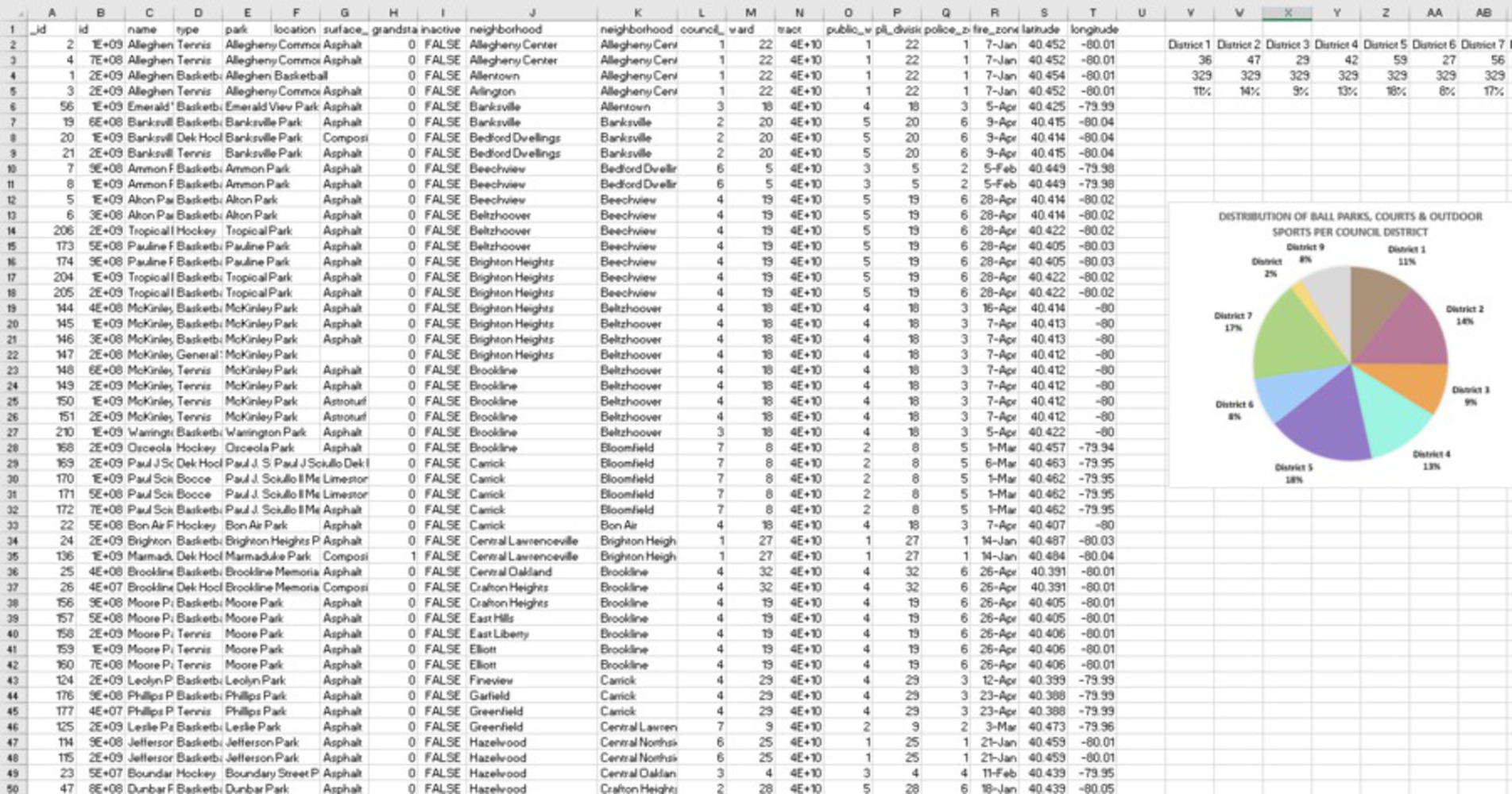
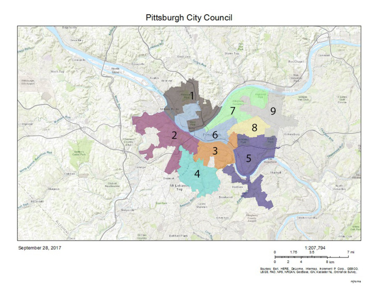
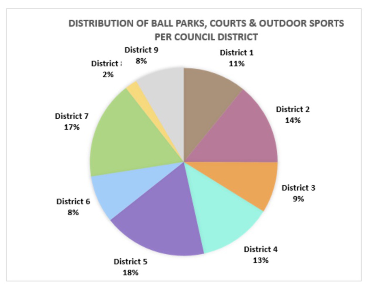
In order to gain a full understanding of public space to promote active lifestyles there are many other datasets that could have been added to the analysis, but in order to make a clear caricature these were the two I focused on and chose to group them via Council Districts rather than individual neighborhoods. Overall this allows for a clearer understanding of the two datasets without over synthesizing the data. 


0

A thorough analysis of the data can be found here: https://tamarac.carto.com/builder/8806ae62-f47b-42c4-8ee5-c65f0fde023c/embed

The Carto map labels the difference from baseball fields, basketball courts, tennis courts and more. This map can be used to hover over and see which sports are most common in specific neighborhoods and districts. I decided to query the athletic spaces. 


0

Above is a sample of the data set. Assuming all of the data collected are fully open to the public, one can gain a better understanding on the Council Districts development and amenities available to residents of the districts. 

Map of Pittsburgh Council Districts:

0

Break down of data analysis:

0

Conclusion:

District 5 has the most parks with 59, followed closely by District 7.

0

A sample of the data specific to district 5 can be downloaded below. Within it you will find neighborhoods such as Regent Square, Shady side, Southside Flats, Southside Slopes, and Squirrel Hill South. These are areas that are well known throughout Pittsburgh as some of the wealthier neighborhoods or those that have become of particular interest to developers. 

x
Share this Project


About

Happy City by Charles Montgomery focuses on the measure of success of a city based on how active the community is. Aligning with that study, is the study of both public and outdoor space. Where does the City of Pittsburgh fall in this alignment?